
From Paper to Performance: Transforming Hazleton City Authority’s Operations with GIS
Across the utility industry, many organizations still rely on paper maps, manual workflows, and fragmented data systems. While familiar, these processes can slow response times, limit visibility, and make it harder to meet increasing regulatory and operational demands. Over the past year, EBA Engineering, Inc. (EBA) partnered with the Hazleton City Authority (HCA) in Pennsylvania to change that, guiding a full transition from paper-based workflows to a modern, integrated geographic information system (GIS).
This transformation began with improving data. EBA migrated HCA’s legacy CAD drawings into a structured GIS environment, creating a centralized and accessible system of record for their assets. This shift alone provided immediate value, replacing static drawings with dynamic, map-based data that can be updated, queried, and analyzed in real-time.
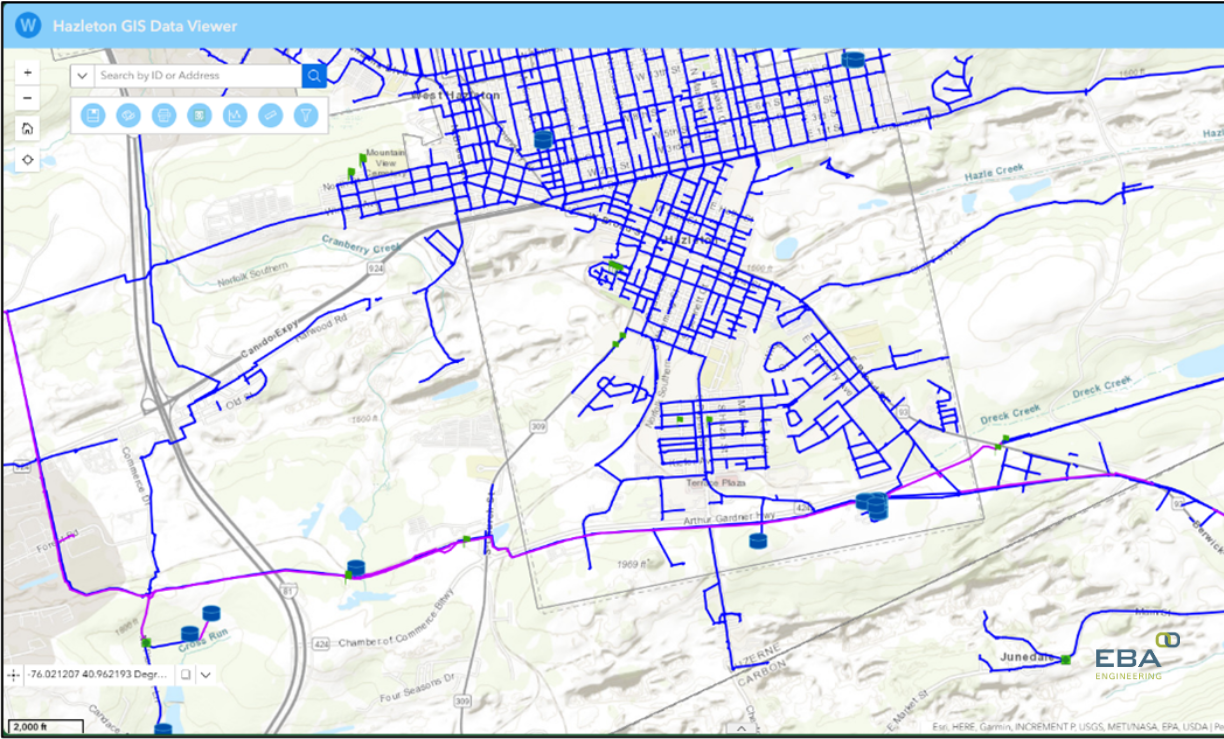
From there, the focus expanded to accessibility and usability. EBA developed a web-based GIS viewer that allows both office and field staff to easily interact with system data. A key feature of this application is the “flag” tool, which enables field crews to mark locations and provide feedback directly from the field. Instead of redlining paper maps and relaying updates through multiple steps, staff can now communicate changes instantly, improving accuracy and reducing delays.
Recognizing that not all users are GIS specialists, EBA also created a simplified data editing application. This tool empowers staff with limited technical experience to make routine updates to the system, ensuring that data remains current without requiring specialized resources.
Supporting this effort, EBA enhanced the dataset itself by creating a Python script that autogenerated and snapped fittings features to the correct watermains. EBA also worked to attach critical documents, such as valve cards, directly to associated features in the data viewer applications.
Field operations saw some of the most significant improvements. By configuring ArcGIS Field Maps and dashboards, EBA helped HCA digitally capture inspections for hydrants, valves, meters, and system flushing. Field crews can now complete inspections digitally, while supervisors can see progress and performance in real time. Work order assignment and tracking have also been modernized through integrated mobile forms (Field Maps and Survey123) and dashboards, enabling better coordination, tracking, and accountability.
Beyond daily operations, GIS has also strengthened HCA’s ability to meet regulatory requirements and plan for the future. EBA supported the automation of lead service line inventory reporting, reducing the manual effort required to compile and submit critical data. Additionally, a restoration tracking application and dashboard were developed to help HCA monitor post-construction sites, ensuring that temporary winter restorations are revisited and completed when conditions improve.
To safeguard this growing digital ecosystem, EBA implemented automated backups of HCA’s cloud-based GIS environment. This added layer of security ensures that critical data is protected against accidental loss, providing peace of mind as reliance on digital systems increases.
This effort has delivered more than just a new set of tools; it’s a fundamental shift in how HCA operates. Information now flows seamlessly between the field and the office. Staff can make faster, more informed decisions. And the organization is better equipped to serve its community with efficiency, accuracy, and transparency.
EBA’s work with HCA demonstrates how thoughtful GIS implementation can do more than replace paper; it can unlock new capabilities, improve communication, and lay the groundwork for smarter utility management in the years ahead.
Joe DeLuca, GISP, is a senior vice president and principal-in-charge of EBA Engineering’s Building Information Modeling and Geospatial Technologies departments. He can be reached at 410.979.3548, joseph.deluca@ebaengineering.com, or on LinkedIn.