
Stay Informed
Sign up to receive industry trends, news, and updates from EBA.

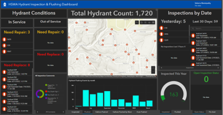
Hampton Shaler Water Authority (HSWA) had a goal to better leverage available GIS capabilities, enhance operational efficiencies, and streamline reporting and analysis efforts by modernizing paper-based workflow processes.
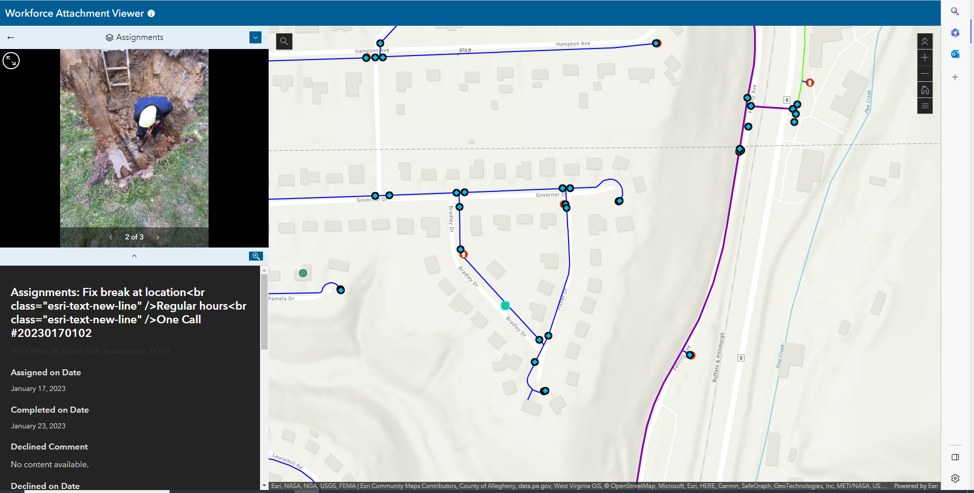
EBA worked with HSWA to identify optimal applications, tools, and processes for their goals. Configuring out-of-the box software to integrate HSWA data into workflow processes eliminated paperwork and realized a quick return on investment. With each effort building on the last, EBA then helped HSWA meet federal lead service line inventory reporting requirements and use GIS to identify locations of non-revenue water loss.
Other helpful tools include:
Having these processes in place helps us to identify leaks that have been an issue for months or years. Thanks to this success, we are looking to invest in additional regional meters and expand the program throughout our service area as appropriate.
Sign up to receive industry trends, news, and updates from EBA.
At EBA, you can count on our commitment to helping you realize your full potential.